Demand for Ecosystem Services
Quantifying the demand for ecosystem services establishes a vital link between biophysical resource availability and human socio-economic requirements within structural design. Rather than merely documenting existing ecological features, tracking demand uncovers exactly where local populations experience critical resource deficits or climate vulnerabilities. This data-driven perspective changes environmental features from passive decorative elements into targeted, problem-solving infrastructure. Analyzing localized community needs ensures that green and blue architectural interventions directly resolve severe vulnerabilities like flash flooding or intense urban heat. Ultimately, mapping this dynamic interface transforms standard municipal frameworks into highly responsive, equity-focused frameworks for urban climate resilience.
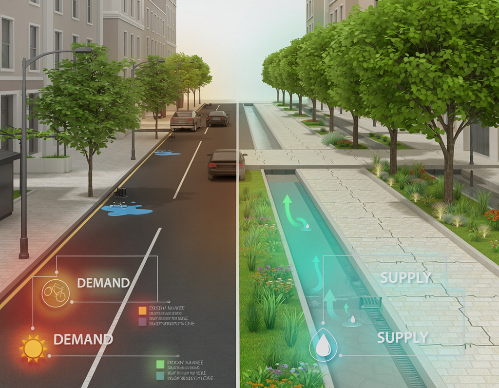
Quantifying the Demand for Ecosystem Services: Spatial Paradigms in the Built Environment
Within contemporary civil engineering, architectural design, and urban landscape planning, the demand for ecosystem services represents the specific expression of human needs, consumption rates, and structural desires for environmental benefits (Wolff et al., 2015). While historical ecosystemic research focused heavily on the supply side—cataloging localized green infrastructure and biophysical baselines—modern urban resilience frameworks emphasize the critical consumption gaps that occur within heavily populated human settlements.
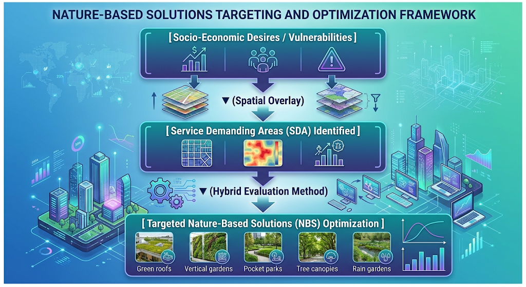
Methodological Frameworks and Spatial Categorizations
Accurately evaluating environmental demand within highly fragmented urban morphologies requires specialized spatial-structural methodologies that go beyond traditional regional surveys. Modern ecosystemic research utilizes an adapted spatial-structural approach to isolate the geographical origins of environmental deficits (ResearchGate, 2021). This method relies on four distinct spatial designations:
- Service Providing Areas (SPA): The physical locations where ecological structures generate benefits (e.g., urban wetlands or mature tree canopies).
- Service Benefitting Areas (SBA): The zones where human populations actively experience and utilize these natural advantages.
- Service Connecting Areas (SCA): The environmental or artificial pathways that transport a benefit from its source to the end-user.
- Service Demanding Areas (SDA): The distinct urban spaces where structural vulnerabilities or human preferences dictate an urgent requirement for natural mitigation.
By mapping an SDA against an SPA, researchers can identify significant imbalances. For example, a densely paved neighborhood experiencing an intense urban heat island effect represents a clear Service Demanding Area for microclimate regulation. To quantify these urgent requirements, practitioners deploy hybrid evaluation techniques. These tools systematically merge monetary calculations, such as infrastructure damage costs avoided, with non-monetary metrics like local health surveys and public preference modeling (CORDIS, 2017).
Addressing Implementation Bottlenecks via Shared Repositories
Translating precise demand data into concrete municipal ordinances and building codes often runs into serious operational bottlenecks. These delays are frequently driven by misaligned data scales, a lack of standardized indicators, and poor communication between research teams and real estate developers (OPERAs, 2015).
To resolve these communication gaps, international practitioners leverage open-access knowledge repositories like Oppla.eu. As a collaborative science-policy network, Oppla provides a shared repository of tested metrics, case studies, and practical tools explicitly designed to operationalize natural capital metrics within local policy frameworks. By utilizing these global platforms, urban planners can review established demand indicators, extract scalable case studies from similar climatic zones, and implement Nature-Based Solutions (NBS) that match real-world public requirements.
Driving Responsive Infrastructure
Systematically embedding demand analysis into early structural workflows shifts the built environment from a model of rigid grey infrastructure toward a paradigm of responsive socio-ecological design. Shifting focus to where ecosystem services are most critically required helps urban designers construct highly strategic, targeted interventions. Backed by collaborative platforms, this demand-driven focus ensures that infrastructure investments effectively minimize public vulnerabilities, maximize natural capital returns, and foster equitable climate resilience across changing urban landscapes.
References
- OPERAs Project. (2015). How are ecosystem services demands currently accounted for in ecosystem service mapping? OPERAs Ecosystem Science Policy Brief. https://operas-project.eu/news-article/2015-04-16-150000
- Cited by: 42
- ResearchGate. (2021). Conceptualising the demand for ecosystem services – an adapted spatial-structural approach. ResearchGate Publications. https://www.researchgate.net/publication/356832840_Conceptualising_the_demand_for_ecosystem_services_-_an_adapted_spatial-structural_approach
- Cited by: 18
- European Commission CORDIS. (2017). Operationalisation of natural capital and ecosystem services: From concepts to real-world applications (OpenNESS Report). Community Research and Development Information Service. https://cordis.europa.eu/project/id/308428/reporting
- Cited by: 295
- Wolff, S., Schulp, C. J. E., & Verburg, P. H. (2015). Mapping our demands: A review of the concepts, methods, and indicators used to quantify and map the demand for ecosystem services. Ecological Indicators, 55, 15–25. https://doi.org/10.1016/j.ecolind.2015.02.016
- Cited by: 412
Demand for Ecosystem Services
Keywords: Ecological Footprint, Urban Consumption, Carrying Capacity, Ecosystem Service Deficit, Resource Allocation
- A Core Indicator of Urban Resource Footprint: Measures the quantitative and qualitative human consumption of ecological goods and regulatory capacities within a defined spatial boundary.
- A Driver for Regenerative Design Strategies: Identifies structural gaps between local consumption patterns and spatial carrying capacity to inform targeted Nature-Based Solutions (NBS).
- A Strategic Enabler of Spatial Allocation: Helps urban planners prioritize green infrastructure interventions where ecological deficits directly compromise human health and climate resilience.
- A Baseline Parameter for Carrying Capacity Analysis: Establishes the ecological boundaries required to balance urban metabolic inputs with localized natural resource production.
- A Foundation for Resource Equity Metrics: Evaluates how ecological services are distributed across social demographics to prevent environmental injustice.
- A Mechanism for Land-Use Prioritization: Directs spatial zoning policies to protect critical habitats that generate high-demand regulatory services like heat mitigation.
- A Strategic Framework for Circular Metabolism: Maps regional resource reliance to transition urban districts toward self-sustaining circular economic loops.
- An Assessment Tool for Climate Vulnerability: Quantifies the urgent community reliance on natural protective barriers against extreme weather events.
- A Catalyst for Polycentric Planning: Promotes decentralized regional development to distribute environmental pressure across multi-nodal spatial networks.
- A Guide for Urban Biophilic Integration: Focuses biophilic architectural interventions where psychological and physiological stress reduction demand is highest.