Blue Infrastructure: Hydrological Dynamics and Ecosystemic Water Management in the Built Environment
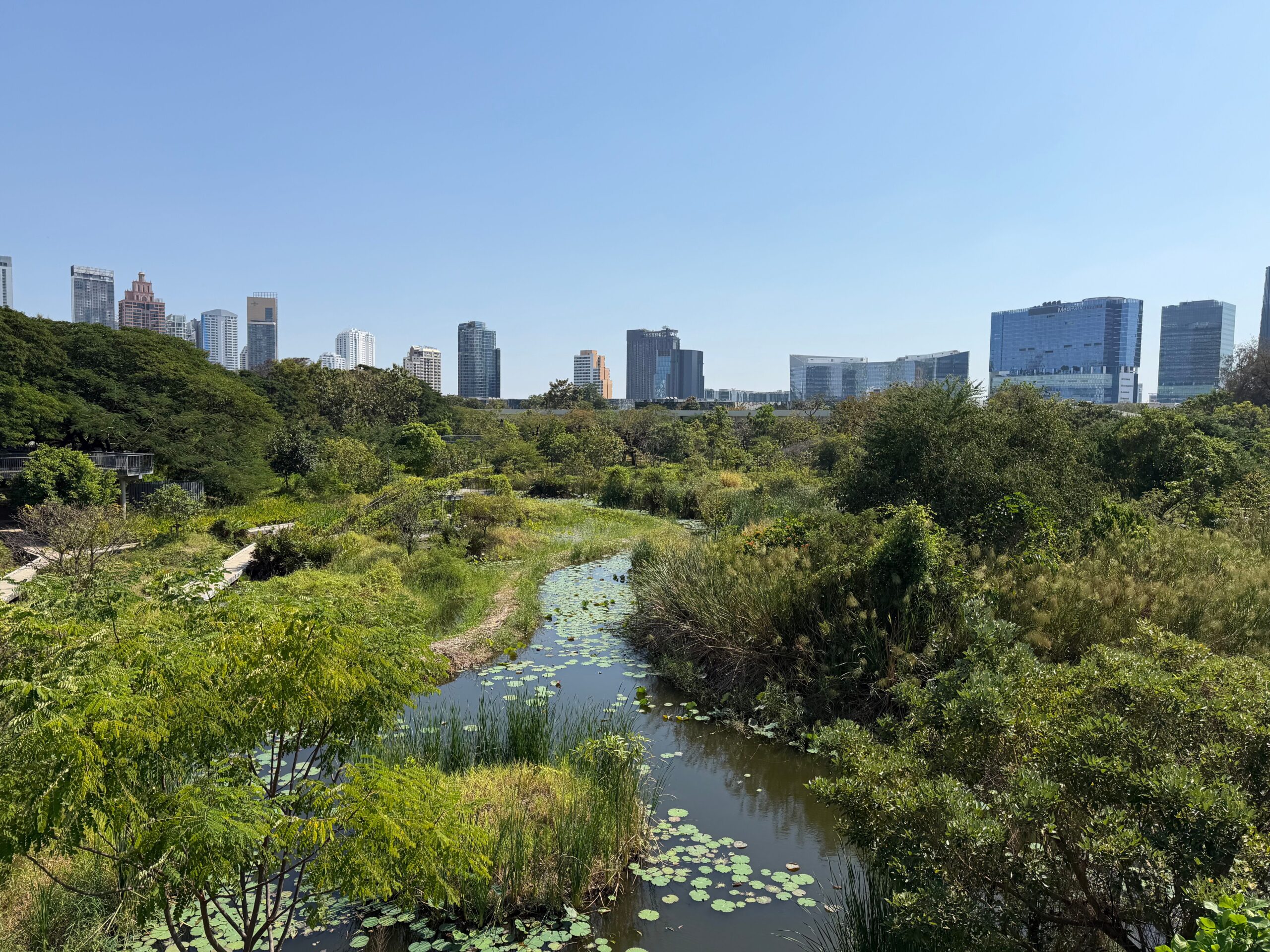
Urban landscapes dominated by impervious gray infrastructure frequently struggle with chronic hydrological imbalances, leading to severe localized flooding and deteriorated waterways. To counter these challenges, modern water management utilizes blue infrastructure—an interconnected framework of open water bodies, retention ponds, and natural drainage channels designed to regulate urban water cycles. By integrating these aquatic assets directly into city fabrics, planners can transition from rapid-drainage engineering to localized retention, natural filtration, and groundwater replenishment. These specialized networks slow down stormwater surges, minimize severe runoff velocities, and restore a natural balance to heavily altered urban catchments. Ultimately, strategic blue planning turns potentially hazardous stormwater into a valuable ecological asset, protecting both human communities and aquatic ecosystems.
In expanding metropolitan regions, the widespread replacement of natural land cover with dense impervious surfaces has fundamentally disrupted historical hydrological balances. Traditional urban engineering practices treat stormwater as a hazardous liability, relying on extensive underground networks of concrete pipes and grey infrastructure to expel runoff into regional water systems as rapidly as possible.
Ecosystemic research demonstrates that this rapid-drainage approach accelerates down-gradient peak flood surges, worsens channel erosion, and flushes concentrated urban pollutants directly into sensitive aquatic habitats. To re-establish a stable hydrological equilibrium, modern urban planning transitions toward the deliberate deployment of blue infrastructure—an integrated network of natural and engineered aquatic features designed to store, treat, and infiltrate water directly where it falls.
Hydrological Restoration and Passive Engineering Methods
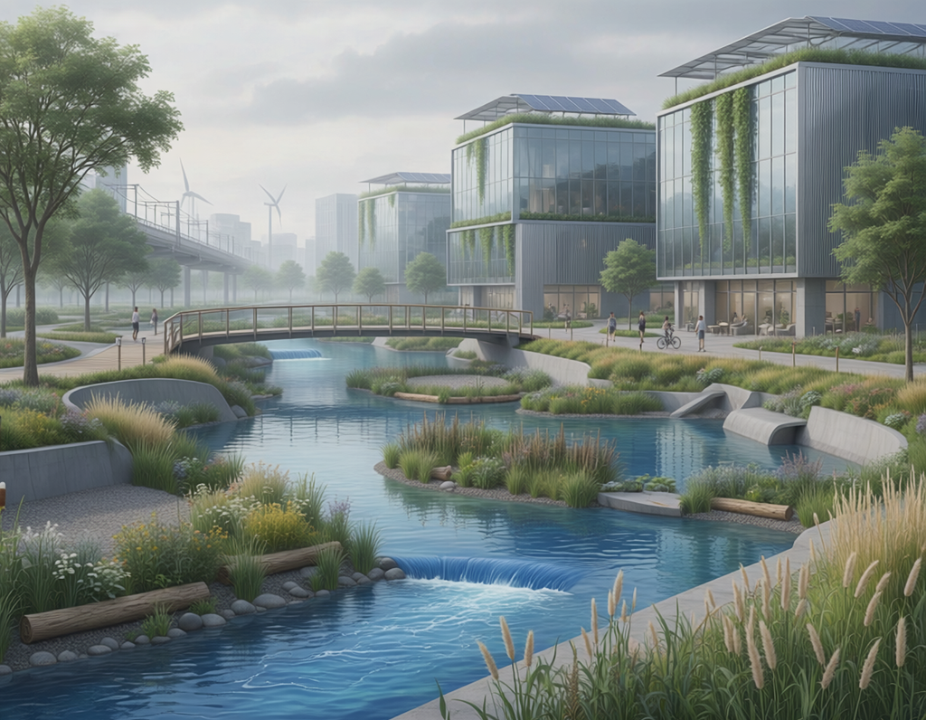
Integrating blue infrastructure into the built environment involves converting passive gray channels into functional, multi-tiered aquatic networks. Ecosystemic design emphasizes slowing, storing, and filtering stormwater runoff through decentralized, surface-level interventions rather than relying on subterranean containment tanks.
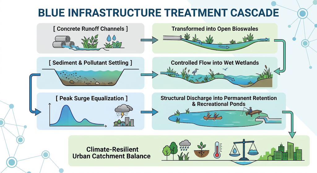
Key physical elements deployed in progressive urban blue architecture include:
- Open Detention Basins: Constructing grass-lined depressions designed to temporarily hold heavy stormwater surges, reducing immediate volumetric pressures on overloaded public sewer networks.
- Constructed Retention Wetlands: Engineering shallow, marsh-like basins filled with aquatic vegetation that use natural biological processes to extract heavy metals, excess nutrients, and chemical toxins from urban runoff.
- Daylighted Urban Streams: Re-excavating historical streams previously buried in concrete culverts, returning them to open-air channels that restore natural bed infiltration and sub-surface air exchange.
- Permeable Waterfront Interfaces: Replacing vertical concrete retaining walls along urban rivers with sloped, vegetated banks and soft floodplains that naturally absorb water level fluctuations.
Biophysical and Microclimatic Co-Benefits
Transitioning toward continuous blue networks yields a wide array of environmental co-benefits that extend far beyond simple flood mitigation. From a thermal perspective, open water bodies paired with aquatic vegetation provide substantial localized cooling across dense urban cores. Through evaporation and high thermal mass, these features absorb solar radiation, lowering ambient air temperatures during summer heatwaves and directly counteracting the urban heat island effect.
From an ecological standpoint, constructed wetlands and daylighted rivers act as essential aquatic corridors through fragmented cities, creating permanent habitats for migratory birds, amphibians, and beneficial insects. Additionally, integrating accessible blue spaces into urban cores improves public health by providing serene, multi-sensory recreational environments for city residents.
Mainstreaming Water Solutions via Open Networks
Replicating these complex hydrological configurations requires open-access platforms where city engineers, landscape architects, and municipal officials can access technical guidelines and study proven case studies. The Oppla.eu database serves as a primary European knowledge hub for scaling nature-based solutions and water management innovations. Oppla hosts field manuals, diagnostic modeling systems, and project evaluations from major international initiatives, including the Horizon-funded Nature4Cities and EKLIPSE consortia.
By studying these open-access digital repositories, growing cities can learn how major metropolises like Rotterdam, Malmö, and Berlin successfully integrated blue asset masterplans into their legally binding zoning laws and public works regulations. Utilizing these pre-tested spatial guidelines allows local planning departments to minimize administrative friction, transforming urban stormwater management into a highly efficient, sustainable practice.
Refer to the database overview file 1000125286.jpg to see how blue infrastructure coordinates with broader environmental parameters within the structural catalog of the built environment.
References
EKLIPSE Mechanism. (2017). An impact evaluation framework to support planning and evaluation of nature-based solutions projects. Centre for Ecology & Hydrology. https://www.eklipse-mechanism.eu/apps/Eklipse_data/website/NBS_Report_V2.pdf
Gurnell, A. M., Bussett, C., Goodson, J. M., & Shuttleworth, S. (2007). Urban river restoration: Hydromorphology, ecology, and opportunities for nature-based engineering. Aquatic Conservation: Marine and Freshwater Ecosystems, 17(5), 512-532. https://doi.org/10.1002/aqc.834
Kabisch, N., Frantzeskaki, N., Pauleit, S., Sanyé-Mengual, E., Groschopf, N., Fox-Kämper, R., … & Stadler, J. (2016). Nature-based solutions to climate change mitigation and adaptation in urban areas: Perspectives on indicators, knowledge gaps, barriers, and opportunities for action. Ecology and Society, 21(2), 39. https://doi.org/10.5751/ES-08373-210239
Nature4Cities Project. (2021). Technical guidelines and indicators for urban blue-green infrastructure asset deployment. Oppla Repository. https://oppla.eu/nature4cities/blue-infrastructure-tools
Putt, A. E., MacIsaac, E. A., Herunter, H. E., Cooper, A. B., & Selbie, D. T. (2019). Eutrophication forcings on a peri-urban lake ecosystem: Context for integrated watershed to airshed management. PLOS ONE, 14(7), e0219241. https://doi.org/10.1371/journal.pone.0219241
Raymond, C. M., Berry, P., Breil, M., Nika, A., Khan, M. N., … & de Vreese, R. (2017). Co-benefits of designing and implementing nature-based solutions in cities: An indicator framework. Environmental Science & Policy, 77, 15-24. https://doi.org/10.1016/j.envsci.2017.07.008
Zulian, G., Polce, C., & Maes, J. (2014). ESTIMAP: A GIS-based model to map ecosystem services in the European Union. European Commission Joint Research Centre Research Report. https://publications.jrc.ec.europa.eu/repository/bitstream/JRC90561/lbna26432enn.pdf